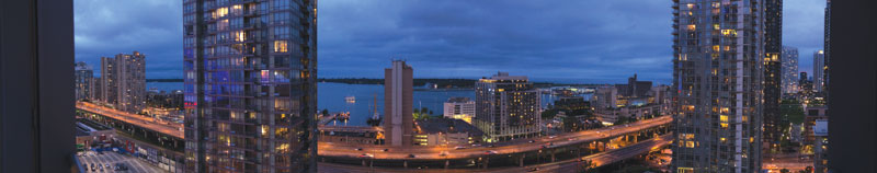

Toronto
Toronto’s Gardiner Expressway runs over-top the downtown core, uncomfortably close to the city’s waterfront, and has long been deteriorating, much to the consternation of pedestrians and motorists underneath who periodically dodge falling bits and pieces. After decades of heated debate, city councillors voted narrowly in June in favour of Mayor John Tory’s “hybrid” proposal, which would see the section from Jarvis Street to the Don River redecked in its current location, and the portion further east removed and reconfigured into an at-grade boulevard. However, with council’s decision calling for further reviews, assessments and reconsiderations, the discussion has every appearance of being dragged kicking and screaming into overtime.
The Gardiner debate feels like it’s been around forever. An early tussle harkens back to a plan that would have hooked the Gardiner into the proposed Scarborough Expressway in the early 1970s. That development never materialized, and by the late 1990s, there was a drive to demolish the expressway’s easternmost end, past where it merged with the north-south Don Valley Parkway. “I championed the whole discussion that resulted in the takedown of the Gardiner from roughly Carlaw Street East to Leslie Street,” said Paul Bedford, the City of Toronto’s chief planner at the time.
While the Gardiner enables freeway access through the downtown core, ongoing downtown densification has left it increasingly clogged during rush hour. However, the roadway has generated particular angst in recent years due to falling concrete. “Because it was in limbo, no money was spent on maintenance and it was in terrible shape,” Bedford recalled from his own tenure. This minimalist state of repair, enough to keep it functional, arguably fuelled a growing sense that the expressway represented a barrier between Toronto and its waterfront. “As chief planner, I put it into a wider context of land use,” Bedford said, referring to his successful push to dismantle the Leslie-Carlaw portion.
Nearly two decades later, the discussion continues. Some worry about losing speedy passage through the downtown if it’s removed; others contend it would be cheaper, smarter, and more efficient to build an at-grade boulevard. In 2003, Bedford oversaw a waterfront plan that proposed mixed use, where people would live, work and play. “It was the whole water’s-edge promenade idea,” he recalled, pointing to new neighbourhoods like the Lower Don, Port Lands, and East Bayfront and plans for public transit. “Expressways do not belong anywhere in that future, as part of that vision,” he contended.
 Montreal
The Gardiner may be uniquely Toronto’s pain, but in Montreal, there’s been considerable discussion about replacing the crumbling, kilometre-long Bonaventure Expressway with a boulevard and park space. Completed in time for Expo ’67, the Bonaventure has been a key link for commuters travelling between Montreal’s downtown core and suburban South Shore. While it, too, is aging and has undergone considerable scrutiny, a final decision was somewhat more easily achieved.
“It became clear that renovating it was going to be extremely costly and probably wasn’t worth it,” explained Raphaël Fischler, director of the School of Urban Planning at McGill University. “It was seen as a win-win solution to tear it down because once it’s over the Lachine Canal it really is a barrier.” Fischler, a specialist in land-use planning, welcomes the plan to dismantle the Bonaventure after the Lachine Canal and move traffic to an urban boulevard down below. “Traffic engineers worry about the flow of traffic, but there’s no problem in this case because you have rights-of-way that are wide enough to have as many lanes as you need for cars,” he said.
While consensus was strong regarding the project’s overall merits, disagreement ensued when the Province of Quebec insisted its financial partnership would depend on the project being able to pay for itself within 10 years. Fischler said the city realized it could only make the project pay for itself by approving and then taxing new development, and such a scheme would demand two separate roadways with large buildings in between rather than the envisioned single, central urban boulevard with abutting green space and more modest development.
“There was strong opposition to the creation of two major streets instead of one urban boulevard,” Fischler said, disputing the notion that infrastructure redevelopment should be profit-driven because this typically isn’t how parks and other public spaces are built. “It was bad urban design for the question of money.”
The province eventually backed down, and the boulevard and green space are back on track. “It’s not going to generate as much revenue,” Fischler said, “but it’s going to look better and be a much better solution for the next 200 to 300 years.”
 Vancouver
A somewhat comparable conversation occurred in Vancouver with the Georgia and Dunsmuir viaducts. The viaducts opened in 1971 as part of a larger freeway network that was supposed to connect downtown Vancouver with North Vancouver, Burnaby, and Richmond. However, demand has since shifted more toward public transit, bicycling, and walking. Brian Jackson, the city’s chief planner, said a city study two years ago indicated the same volume of traffic could be accommodated at-grade as it has been with the two elevated structures. So while plans for Toronto’s Gardiner seem stuck in traffic, Vancouver’s transformation is proceeding more swiftly. Some study results are already in hand, and planning staff are reviewing detailed cost analyses and other suggestions tacked on to city council’s otherwise unanimous approval. “The unanimous vote of council is very rare on such a large issue,” Jackson said, pointing to solid support not only from environmental and community activists, but from local business groups.
Of course, Vancouver is a younger city than Toronto or Montreal and has fewer age spots. “They (viaducts) don’t have concrete falling off like the Gardiner Expressway does, but at the same time there’s an ongoing operating cost to keeping these structures in the air,” Jackson said. What makes removal of the elevated roadways particularly appealing is it will enable the city to reconnect the False Creek neighbourhood to the downtown. “It’s an opportunity to get rid of a physical and psychological barrier between neighbourhoods that have been viewed in the past as underprivileged and isolated and knit them more cohesively into the city fabric,” Jackson explained. The removal of the viaducts also opens up access to city-owned land for use as park space, affordable housing, and some taxable development.
Considering change
When considering significant changes to transportation infrastructure, Jackson said it’s vital to understand the full picture. “It isn’t just a planning issue or just an engineering issue, or just about building and reconnecting communities—it’s all of these,” he said, invoking Boston’s Big Dig as an example where an over-riding vision and long-term, strategic thinking generated broad public excitement and support. “Boston did it because they knew 20 to 30 years out that they needed to do it in order to be able to compete on a world stage and have a downtown that was much more livable than it was by having a waterfront freeway.” Jackson said Vancouver has set out to be the greenest city in the world by 2020, and removal of the viaducts is a vital step in that direction.
In Montreal, Raphaël Fischler said the debates make it clear that infrastructure decisions involve financial calculation as well as urban planning and design, and that it can take considerable effort to build consensus. “Sometimes you have to have good compromises in order to get the quality of plan you’re seeking,” he said. “You may have to pay more money or you may have to derive less revenue from development, but that’s an important political choice. If you’re profit maximizing, you’re really constraining yourself in terms of design and planning.”
From his vista in Toronto, Paul Bedford looks to New York City’s West Side Highway as a model for what can be accomplished. “It was exactly the same as the Gardiner,” he said. “It was elevated along the entire west side of Manhattan, all along the Hudson River. They had a big debate, and the long and the short of it is they took it down from 57th Street south to the tip of Manhattan, and it’s now a big, wide urban boulevard. It’s been absolutely, phenomenally successful.”
While there’s new momentum in Toronto, the fate of the Gardiner is still up in the air. Even with the hybrid proposal approved by city council, Toronto’s public works committee was expected to review various options in September. Bedford said one of these would have the section from Jarvis Street to the Don River demolished rather than redecked, and traffic relocated to run atop an earthen berm alongside an existing, nearby rail line.
Waterfronts, Bedford said, are hardly the place for elevated expressways. “That’s a mindset of the 1950s and ’60s. When the Gardiner was built, Toronto’s waterfront was full of heavy industrial. Nobody lived there and no one visited there. But it doesn’t make any sense at all today. Most cities only have one waterfront, and it’s the gateway to our city.”
Saul Chernos is a Toronto-based writer specializing in environmental issues and a regular contributor to ReNew Canada.